
This is an enhanced electronic excerpt reprint from the official National Park Service "Ozark National Scenic Riverways Park" map located on the web at: http://www.nps.gov/ozar/pphtml/maps.html.
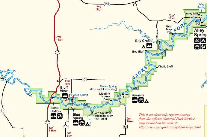
Jacks Fork River
MDC South Prong Access at Hwy. Y Bridge. Beautiful section, but not recommended during low-water.
Chimney Rock Cave in hill on right.
State Hwy. 17 Bridge at "Buck Hollow." Usual put-in for upper section of river. Park Service campground.
Salvation Army camp on left. Access, camp.
Blue Spring comes from cave on left nearly hidden from river by boulders. Narrow run just below spring may be difficult.
Jam Up Bluff and Cave. River entrance of cave is one of the most spectacular cave entrances in state. Cave may be explored in daylight back to lake which is plunge-basin for falls from upper part of cave. Upper section entered through a sinkhole in Lost Hollow which may be reached by climbing up the bluff.
Ebb and Flow Spring on left.
Bunker Hill (Missouri State Teachers Association resort) on left. No access.
Leatherwood Creek on left.
Bay Creek on left. Access, camp.
Alley Spring, 10th largest spring in state. Old mill, camping, access.